Back
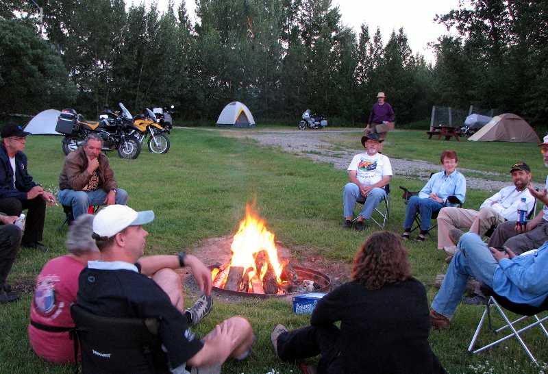
First up was the Lunatic Fringe rally put on by the Rocky Bow BMW Riders in High River, Alberta. It was a small affair this year because of a conflict in the rally schedule with a big national event held in Boise, Idaho on the same July 8 weekend. Nevertheless, we had a great time. The long distance award went to Paul Harper who flew his bike to the east coast of the U.S. from the U.K. and had spent a few weeks on the road working his way west. (www.thebigbiketrip.com) We led a ride-out on Saturday morning and put on the field events in the afternoon and while the word "diabolical" did not come up there were some comments made about how challenging the events were. On Sunday morning, July 9, we packed up and headed north, hoping to camp in Jasper that evening. We only made it a couple of blocks when Audrey motioned that the oil pressure light on her F650GS was on. Uh oh. We performed a few simple checks but the light refused to go out so we called the CAA for a tow. When the tow truck driver showed up with a motorcycle trailer we thought we would be in good hands but when he said that he had never towed a bike before a bit of uneasiness crept in. We doubled up on the R1150 and followed the tow truck all the way to Blackfoot Cycle. Followed at a respectable distance that is, in case the unthinkable happened and Audrey's bike went for a tumble.
Around the campfire at the Lunatic Fringe BMW rally
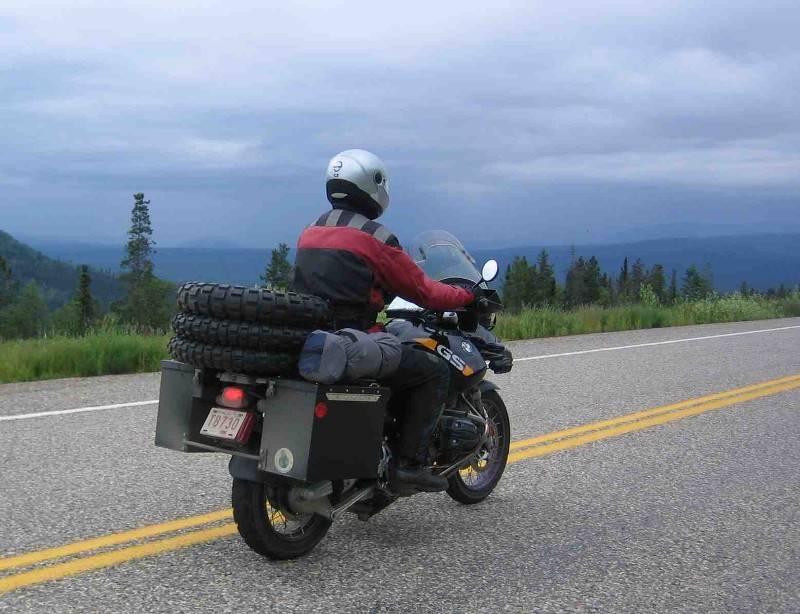
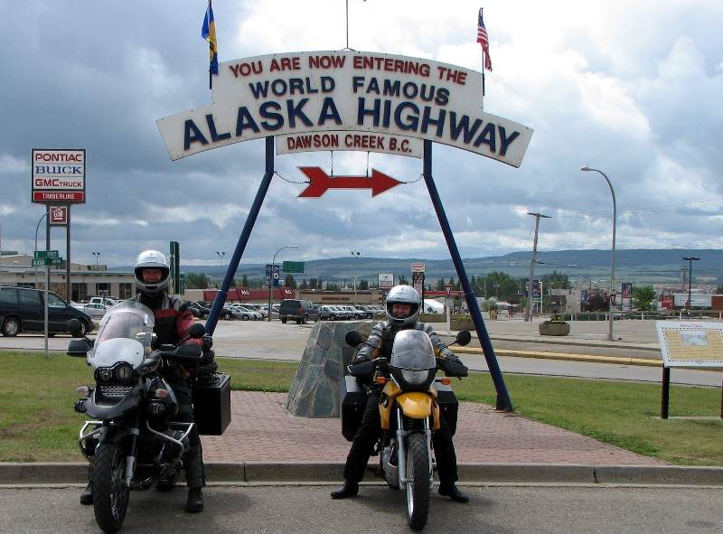
Blackfoot checked the F650 over on Monday and found that the oil pressure sensor wiring had shorted out, an easy fix. Finally, Tuesday morning we rode north, skipping Jasper and having only lost a couple of days. Highway 22 was not terribly interesting but we made good time. In a couple of days we were at the start of the Alaska Highway in Dawson Creek. Wherever we stopped, be it for fuel or simply for a break, people would come up to us and start a conversation. So, if you are ever starved for company simply strap a couple of knobbly tires to the back of a motorcycle and hang out at a coffee shop!
Conversation starters
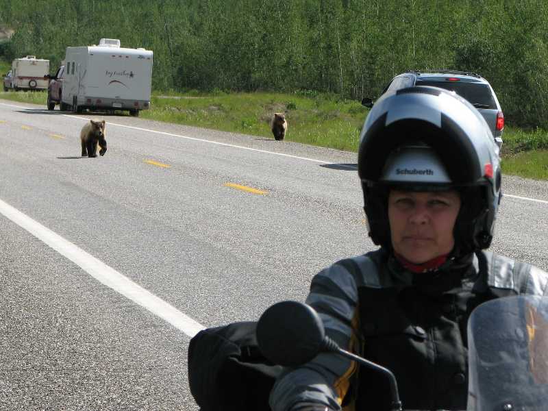
The famous Alaska Highway turned out to be a pretty easy ride. All smooth pavement with only a few construction zones where rock chips were being put down. A bit of excitement happened when a caribou jumped out from behind a parked motorhome right into our path. Thank goodness for powerful brakes and quick reaction times or we could have had caribou burgers for lunch. The Alaska Highway did present us with a lot of wildlife. A couple of grizzly bear cubs had us wondering where mama bear was and a small fox walking toward us in the middle of the opposite lane ignored us completely when we rode by. It was probably too busy balancing a large bird in its jaws to even see us.
A local newspaper reporter takes our photo in Dawson Creek
Where's mom?
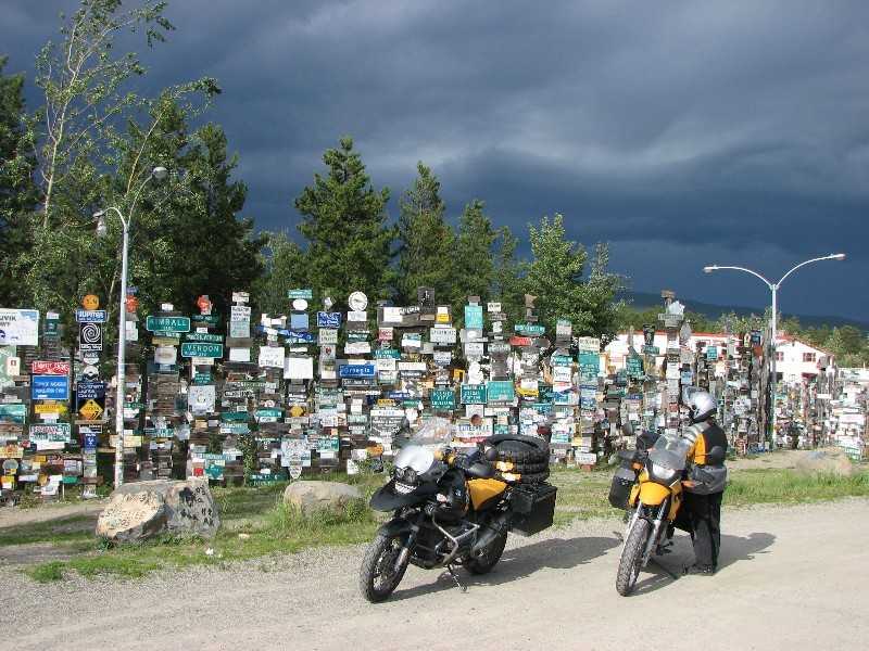
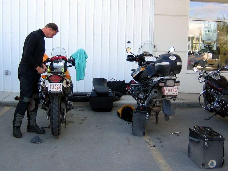
After a mid-afternoon dip in the Liard Hot Springs we crossed the 60th parallel into the Yukon Territory on Thursday the 13th of July. We camped at Watson Lake, home of the famous sign-post forest, and found the mosquitoes to be almost unbearable. A cooking shelter with screened windows allowed us to make and eat supper in a protected environment. A short ride on Friday got us to Whitehorse where we hoped to mount the knobbly tires to take us on the gravel roads up to Inuvik. The first motorcycle shop we stopped at said that they could mount the tires but it would be about two weeks to the next available appointment. Down the street, Yukon Honda, was much more accommodating. I pulled the wheels, one by one, off the bikes and the parts manager mounted the tires right away. Great service and only $20 for each tire. By the time we got to the Greyhound depot they were closed for the weekend so we ended up taking the street tires to Mailboxes Etc. to ship back home. While the knobbly tires were great conversation starters when strapped to the back of the bikes they did make it rather awkward to get into the luggage so we were glad to be rid of that burden. The Robert Service Campground in Whitehorse was a very nice facility but unfortunately the July 15th weekend had a softball tournament at the diamonds across the road. Softball partiers at the campground made it rather unpleasant but at least we had earplugs with us. Another advantage to travelling by motorcycle!
Watson Lake signpost forest
Yukon Honda
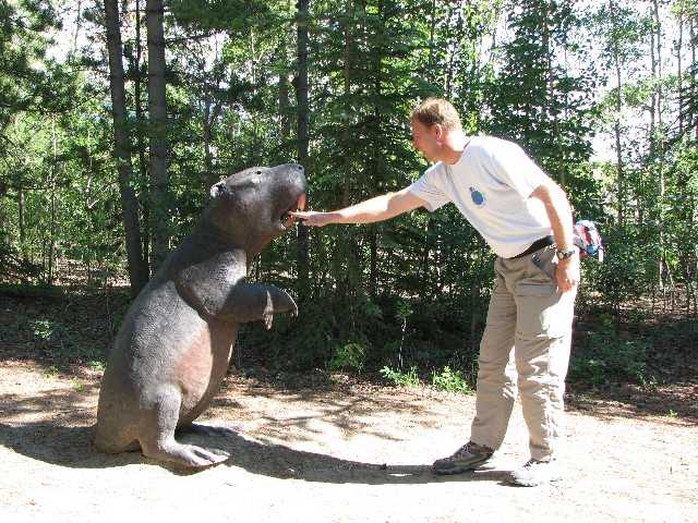
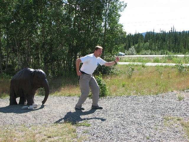
Saturday we did a walking tour of Whitehorse. Starting at the campground we climbed up the escarpment around the airport to Beringia. This is a great interactive museum of the time of the last ice age, the time of the great woolly mammoth. Did you know that the modern camel evolved in North America or that this part of the Yukon was not under a great sheet of ice during the ice age? We got to try throwing a spear using an adladl, under the watchful eye of an interpreter, and discovered that Audrey has the better throwing arm. The only way I could have put food on the table 10,000 years ago would have been if the 400 pound beaver walked into the pot all by itself. After the museum we walked around the other side of the airport and down the escarpment to downtown Whitehorse. It truly is a nice, small city on the banks of the Yukon River.
400 lb beaver from the time of Beringia
Look out Audrey!
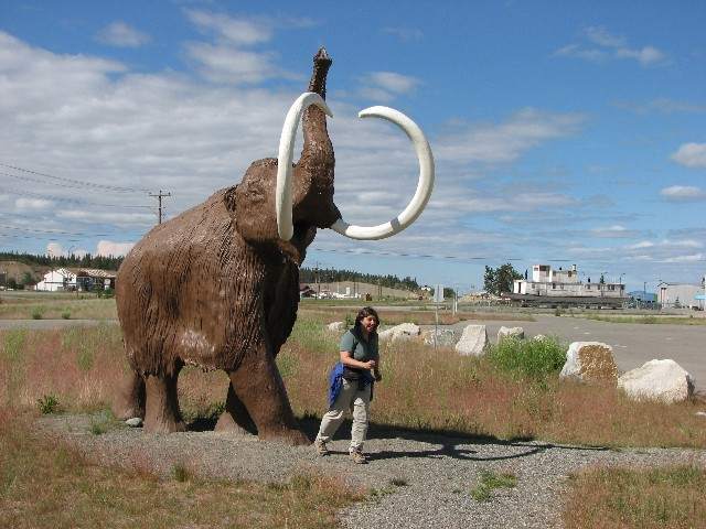
Run, Ekke, run!
We departed from the Alaska Highway on Sunday morning, turning north on the Klondike Highway to Dawson. Again, this road was perfectly paved and the riding was easy as we paralleled the Yukon River, the route taken by the Klondike Gold Stampeders. As we passed the intersection with the Dempster Highway we looked over and saw that the road seemed in pretty good shape. Nevertheless, we stopped in at the Yukon and Northwest Territories information centres in Dawson to get an idea of the road conditions up to Inuvik. We were told that the highway is well travelled and in good shape up to Tombstone Territorial Park, about 70 kilometres. After that the gravel gets looser and deeper so the riding should be more challenging. We were also warned about the shale used for the road near Eagle Plains as it can shred tires. The good news was that the weather forecast for the next few days was warm and dry, with a high of 24 Celsius in Inuvik. The Dempster has a reputation as an extremely challenging road on a motorcycle when it is wet so we were very happy.
On July 17th we rode back down the Klondike Highway a few kilometres to the intersection with the Dempster where a gas station allowed us to fill up since it is about 370 kilometres to the next station at Eagle Plains. In the café Tom, the owner of a BMW R1100GS parked outside, was polishing off a delicious looking breakfast so we joined him in a cup of coffee and exchanged stories. He had made the run up to Inuvik and back a couple of days ago and said the road was in great shape. We must have made an impression on him since he visited Anderwerks (www.anderwerks.com) in Calgary for some much needed service on his bike based on our recommendation and we met up again at the Horizons Unlimited gathering near Nelson, B.C. (www.horizonsunlimited.com/meetings/CanWest2006.php) a few weeks later. While Tom headed south we headed north. After a few hundred metres of pavement the road turned to gravel but it wasn't threatening at all, being very well packed. We kept the speed down to about 80 km/h though we could have gone much faster. This allowed us to enjoy the scenery as well as improve the fuel economy of the bikes. As per the visitor information, the ride to Tombstone was easy and the park itself was spectacular. We hoped to stay at the campground on the return trip. Beyond the park the road turned to looser gravel but we simply took it easy and enjoyed the ride. Until we hit a construction zone. Then it wasn't as enjoyable because the watered down clay provided an incredibly slippery surface, causing the bikes to slither from side to side, even with the nice, new knobbly tires. We couldn't imagine doing this in the rain for 1,500 kilometres back and forth to Inuvik at 30 km/h. We made it to Eagle Plains in the late afternoon and set up the tent. Rather than sit out with the mosquitoes making supper and since we were tired from the ride we elected to go into the lodge. The fish burger and the beef dip were pretty good!
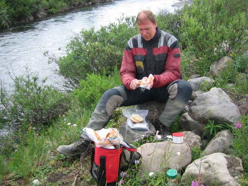
Lunch on the tundra
Panorama along the Dempster Highway
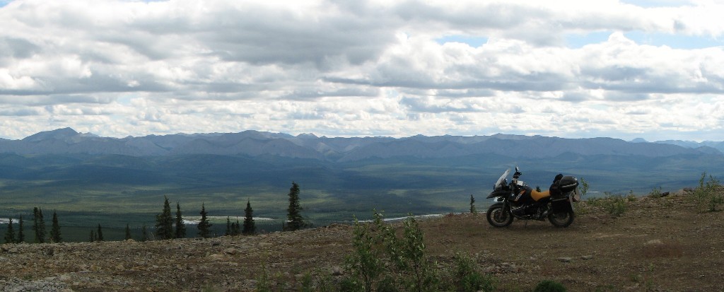
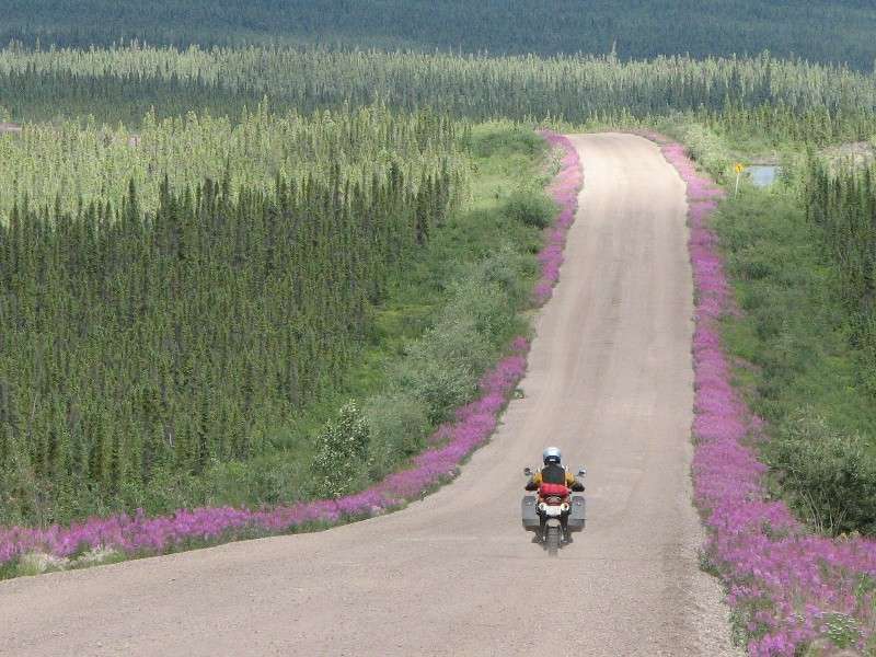
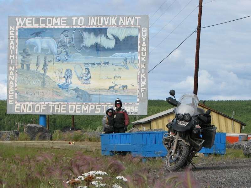
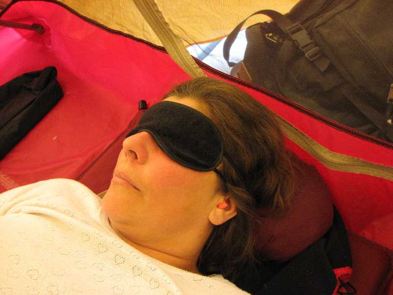
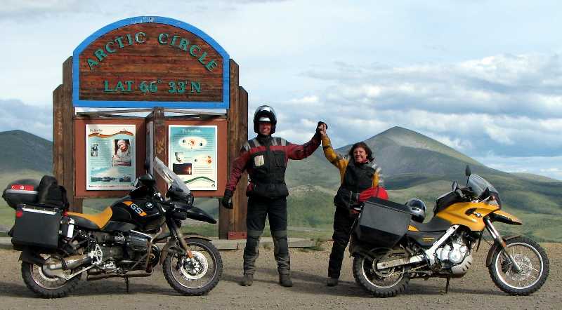
The next morning we continued riding north. The shale around Eagle Plains wasn't that bad for the bikes and actually provided a bit of a respite from the loose gravel. With Fireweed framing the road we rode the short distance to the Arctic Circle for the obligatory photo. Then, riding through rolling hills we crested the pass in the Richardson Mountains that signalled the border between the Yukon Territory and the Northwest Territories. The stark beauty of the landscape was difficult to capture in photographs. At a view point overlooking the Ogilvie Ridge one could see a total distance of 180 kilometres and we know that there wasn't a soul in that panoramic vista. For that matter, there wasn't a living soul on the other side of the mountains either, perhaps for another thousand kilometres. That's what made the few people we met on the highway that much more special. Since there aren't many turnoffs from the Dempster Highway and everyone drives at approximately the same speed we tended to see the same people over and over. When we pulled over for a break if someone happened along they always stopped to see if we were OK. The automobile drivers seemed to suffer from a fair number of flat tires but our new knobblies had no troubles handling the sharp rocks. The road on the NWT side of the pass seemed to us to be a bit more challenging, with looser and deeper gravel. The ferries across the Peel and Mackenzie Rivers presented their own challenges as the approach ramps were dirt that had been pounded by heavy truck traffic. Once across the Peel River, and onto the Mackenzie Delta, the road became straight as an arrow and the scraggly trees were interrupted only by the occasional swamp. Still the loose gravel made the riding challenging and when we arrived in Inuvik we were exhausted. Dinner (Muskox burger!) and a celebratory Banana Split at the Eskimo Inn were about all we could manage after a walk around town. We were glad to have brought our "sleep masks" as the GPS indicated that we only had thirteen minutes of night, from 2:54 AM to 3:07 AM.
Fireweed frames the ride
Wright Pass
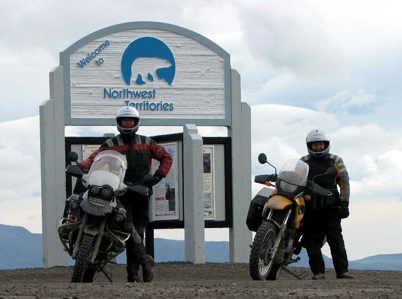
Happy!
Sleep mask required at Midnight
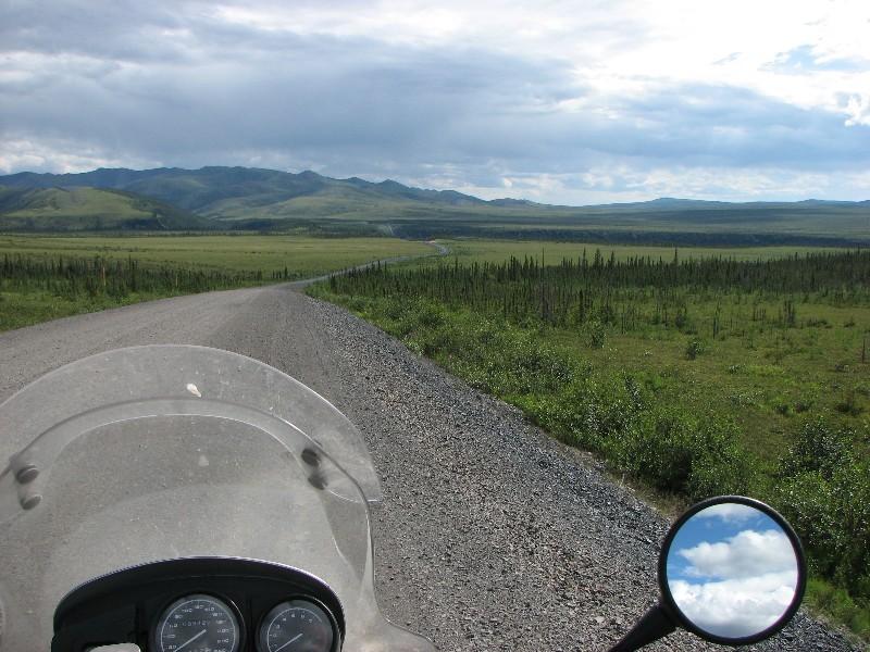
It would have been nice to spend a little time in Inuvik, especially since there was an arts festival going on, but having experienced the construction zones with the wet clay we decided to take advantage of the dry weather and ride back south. We couldn't believe how different the road was. It looked exactly the same but we were riding on gravel at 80 to 90 km/h that the day before had us going 60. The only thing we could tell that was different was that we were fresh in the morning whereas the previous afternoon we were tired. Twenty or thirty kilometres before the pass over the Richardson Mountains a motorcyclist coming from the other direction flagged us down and warned us about the loose gravel. This seemed like an odd statement since we had obviously been riding on gravel for a thousand kilometres up to Inuvik and back. He clarified and said that the loose gravel at the top of the pass combined with a strong cross wind had almost blown him off the road. Keeping that in mind we ascended the pass without difficulty. On the Yukon side, an especially strong and gusty wind came up and because we were standing on the pegs to balance the bikes on the loose gravel we were like human sails, catching the wind. Combined with a steep drop-off this made for some of the most exciting riding on the Dempster. (Audrey thinks I should use a stronger word than "exciting" here!) By the time we got back to Eagle Plains we were going 60 in places where we were going 80 the day before, so maybe the freshness theory has some validity. This is certainly something we should keep in mind for the rest of the trip.
Look out for the loose gravel
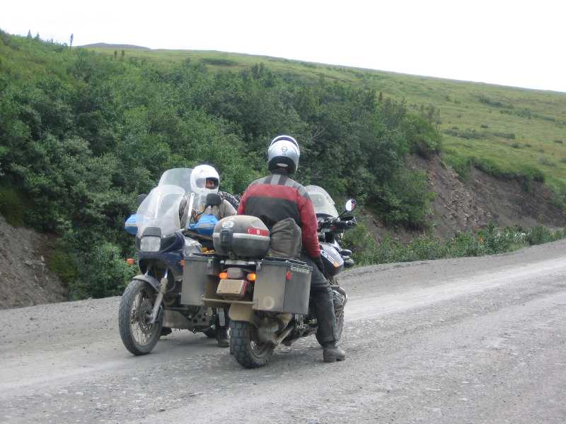
Balancing the bike by standing up on the pegs. Before the wind gusts...
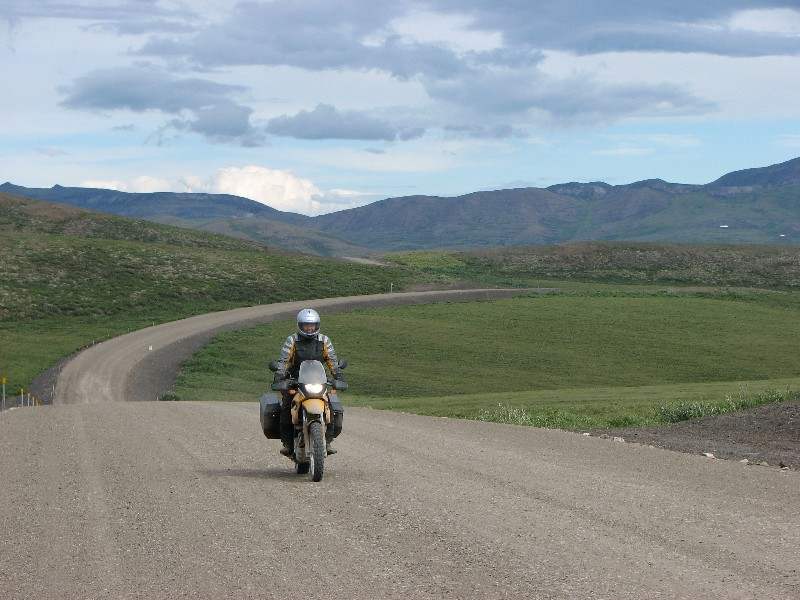
Heading south
Crossing a famous latitude on our "Longitudinal Way Round"
A short ride took us from Eagle Plains to Tombstone Park where we stayed overnight. Arriving in the early afternoon allowed us to go for a nice hike in the park. While bushwhacking beside a stream we encountered a group of hikers returning from a five day hike back from Tombstone Mountain where they had been dropped off by a helicopter. What an adventure! Back at camp a pair of German motorcyclists had put up their tent near us. One of them was on a modern bike similar to ours but the other rider was on a forty year old BMW. Another adventure!
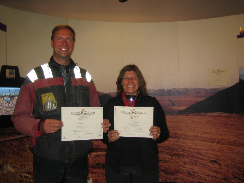
From Tombstone it was a short ride back to Dawson where a music festival was in full swing. The town was hopping with activity. We picked up our certificates for completing the Dempster Highway and crossing the Arctic Circle at the visitor info centre and got some information on historical tours. First up was a visit to the Robert Service cabin and a poetry reading by a Parks Canada interpreter. He was fabulous! We learned a lot and were well entertained. After that we jumped back on the bikes and rode up to historic Dredge No. 4. There another Parks Canada interpreter gave us a tour of the dredge and filled our heads with even more information. Back at camp (we were staying at the downtown RV park) we found another tent sharing our gravel spot. These people were down specifically for the music festival and the ensuing party. Our hopes that they would be fairly quiet were dashed as they talked well into the night. On the advice of the info centre staff we had avoided the government campground across the river since it has a reputation of being quite rowdy during the music festival. She had heard of the softball tournament rowdiness in Whitehorse and so recommended the downtown RV park. Too bad about the noisy neighbours and the loud music (a kilometre away!) but we were glad that it didn't get too rowdy.
Completion certificates at the NWT information centre
A Robert Service poetry reading by a Parks Canada interpreter
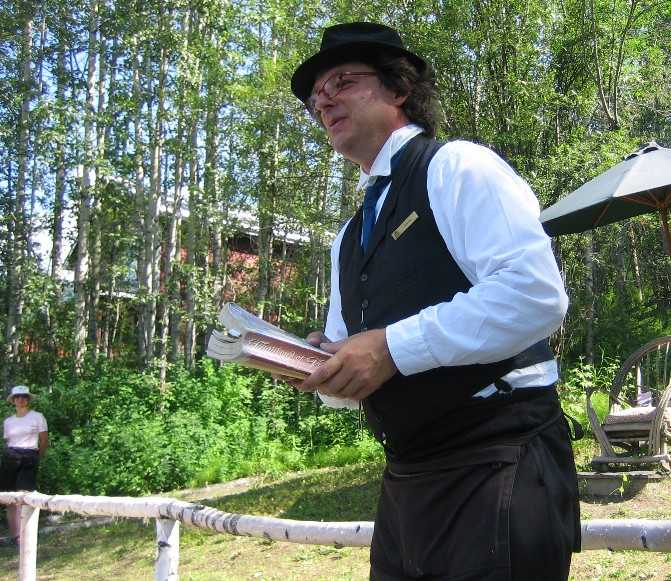
In the morning we did laundry and went over the bikes for loose bolts before taking one more Parks Canada tour. This time an interpreter took us for a walk around town, telling stories of the gold rush time period. Stories like the one about Soapy Smith in Skagway who opened a telegraph office that didn't have any telegraph wires connected to the outside world. He would take the message from the gold rush prospector and then come back to the customer and say that the reply was to "send money!" In reality no message was sent and Soapy pocketed some nice change. Another story was about the mortuary. Apparently the undertaker would size people up during the summer if they weren't looking very healthy. He would then dig the hole before the ground froze so that if the person died during the winter he wouldn't need to store the body. We packed the bikes back at the RV park and after lunch at a picnic table on the bank of the Yukon River we headed west. While the Top of the World Highway was ostensibly paved to the border it was in a sad state of repair, undergoing a fair bit of work with long stretches of loose gravel. We entered Alaska at Poker creek and rode a narrow, winding gravel road to Chicken. The story of how Chicken got its name was interesting; apparently the original settlers wanted to call it Ptarmigan but couldn't spell it! From Chicken a beautiful paved road took us past forest fires to Tok River State Park campground.
Parks Canada interpreter starts a tour of Dawson City
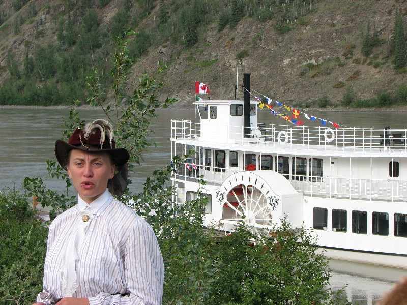
Over the Top of the World Highway
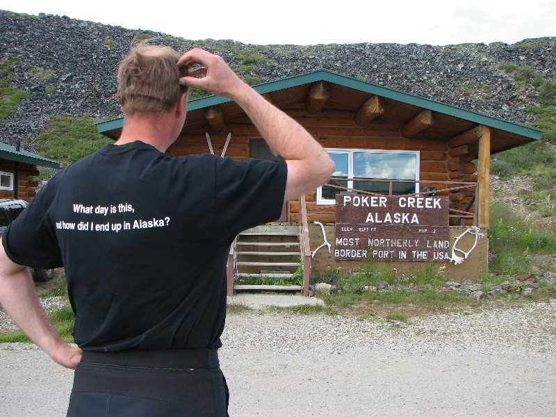
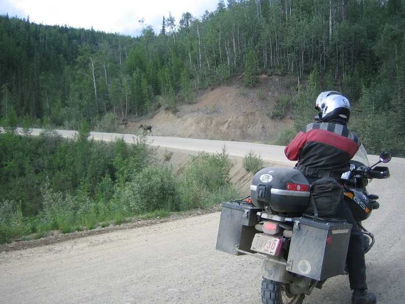
Taking pictures of a couple of moose
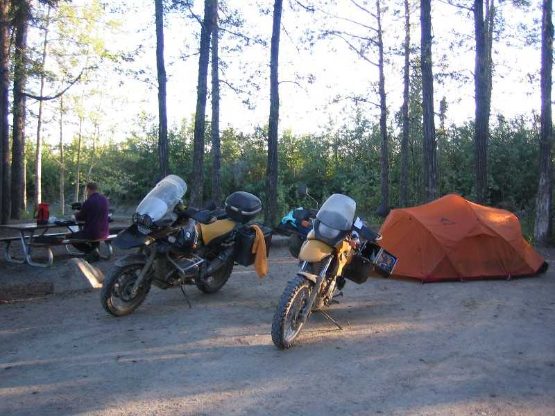
Tok River State Park
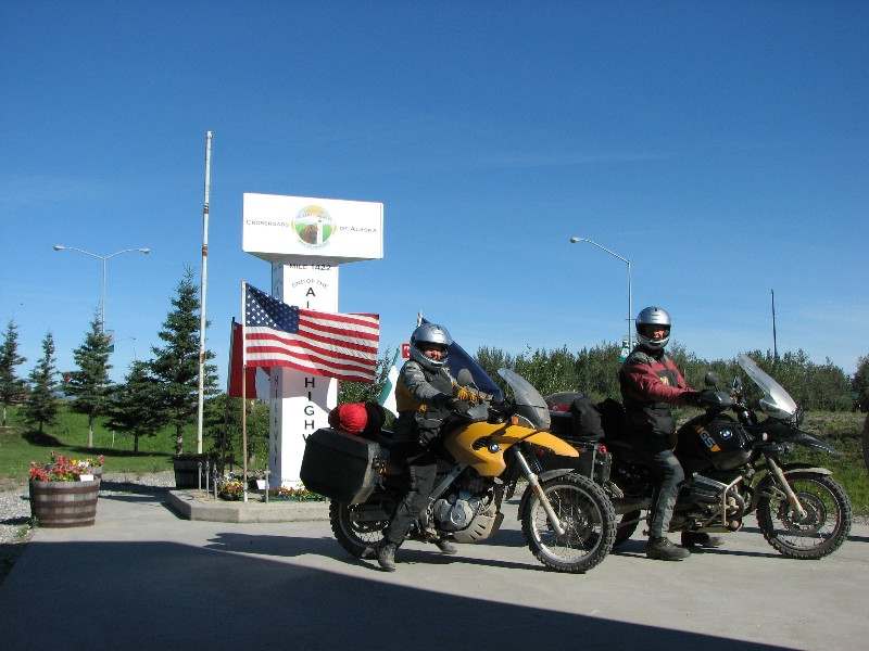
600 kilometres took us all the way to Denali National Park via Fairbanks on July 23. First we stopped at Delta Junction for the obligatory photo at the official end of the Alaska Highway. The sign wasn't anywhere near the road or the parking lot so we just rode the bikes up onto the sidewalk and then carefully balanced the camera on a garbage can to take the picture. We picked up a few groceries in Fairbanks and then had lunch on the fair banks of the Chena River that runs through the centre of town. The peace and quiet of the riverside picnic was shattered when speed boats and Jet-Skis went ripping by but other than that it was a great place for lunch. It was so warm that it was rather tempting to join them! In the late afternoon we arrived in Denali National Park and discovered one of the most confusing systems for transporting people and finding a campground we have ever seen. Perhaps their system works for locals who know the system and for tourists who have come here as a destination and have done their research but for us just dropping in out of the blue it was bizarre. Only the first part of the park is accessible by private vehicles so it is necessary to take a bus to go further in to the park and the bus must be booked in advance. Fortunately the line for talking to a park officer was long so we had plenty of time to try and figure the system out. There was a campground, accessible by private vehicle, a couple of kilometres back and they had a vacancy for walk-in campers. We could have booked a bus for a day trip for the next day but the one-way rides seemed really long (and slow) not to mention expensive. As it was, we were spending $32 just to camp for the night. Then we discovered that showers were $4 each. We thought that Denali might be expensive but not that much and we didn't expect it to be as busy as Yosemite or Yellowstone to boot. Since we were at a walk-in spot we parked the bikes in the parking lot and then carried all of our camping equipment a kilometre past all the RV spots. Later we thought, "Why didn't we just park the bikes in front of the camp spot to unload and then ride back to the parking lot?" but the exercise was a good warm up for the next day.
Official end of the Alaska Highway at Delta Junction
Healy Lookout was about a nine kilometre hike from the campground with 550 metres of elevation gain. We took a slightly different route having to cross an airfield and a set of railway tracks after bushwhacking for a kilometre or two before we started on the right trail. No views of Mt. McKinley were to be had from the top but we could see further up the valley into the park. Back at the campground we had a quick lunch before packing up and riding south to Anchorage. A few spots along the road were supposed to provide views of the tallest mountain in North America but the clouds and occasional rain obscured any peek we might have had. We arrived in Anchorage in the late afternoon and toured the small city before having supper at a Wendy's. We asked some locals for camping possibilities and were told that we had passed Eagle River state park coming in so we went back there to set up camp for the night. It was a long day with the hike in the morning and the 400 kilometre ride in the afternoon so we were pretty happy to see our tent set up by 10:20 PM.
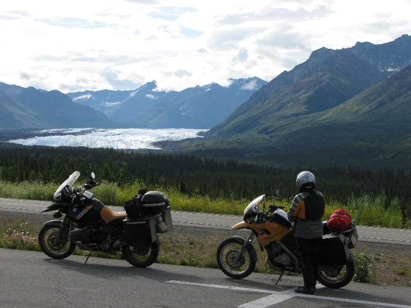
July 25 we rode about 500 kilometres back to Tok River. We passed the Matanuska Glacier on the Glenn Highway and then stopped for lunch in Eureka. A couple of Swiss riders came in just as we were leaving so we chatted for a little while before continuing north. After a short stretch on the Richardson Highway we took the Tok Cutoff for one of the most challenging rides of the entire trip. The road wasn't so bad but the construction just outside of Tok was horrendous. By now we had plenty of experience on gravel but this stuff was composed of softball sized and shaped rocks. One of the flag persons waved the motorcycles to the front so that we wouldn't have to ride in the dust which would have been terrific if we weren't behind a couple of really nice custom Harleys from whatever state has licence plates that read, "First in Flight". They rode at 5 kph and at that speed the bikes were so unstable that it was a real fight to stay upright. Finally we stood up on the pegs and passed them, trying not to spray their nice paint jobs with gravel, and once we got up to a reasonable speed it wasn't nearly as scary.
Matanuska Glacier
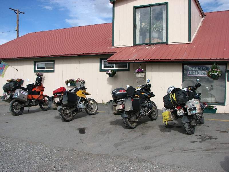
A couple of Swiss bikers stop in just as we're leaving Eureka
The 620 kilometres to Whitehorse could have gone a bit faster without the construction at beautiful Kluane Lake or the incredibly long time for tea and toast to be delivered at the restaurant in Beaver Creek. As Canada's westernmost community perhaps the residents are used to being behind the rest of Canada and were in no hurry to serve us? After the cool and damp ride the hot showers at Robert Service campground were especially welcome.
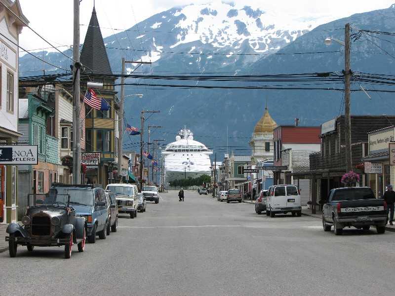
Who would have thought that a 200 kilometre ride could be so miserable? That's all it was to Skagway over the White Pass but it was so cold, wet and foggy that not only did we see nothing we were soaked and freezing. On the bright side, the border guard entering the U.S. was the friendliest border guard we have ever met. He sympathised with our wet condition by not needing to see our paperwork and telling us that it was only eight miles into town where nice warm, dry hotels were waiting. We took his advice and settled in to the Westmark Inn to dry all of our stuff out, rather than camping near the head of the Chilkoot Trail. We picked up our train tickets and then checked in at the park office to register for the trail. The park warden wasn't too happy with our decision to hike the trail in 2.5 days, saying that we could not possibly enjoy the hike and its historical significance in that time. Oh well, the train was booked and it was scheduled to depart from Lake Bennett at 1:30 PM on Sunday and the ferry to Prince Rupert was booked and scheduled to depart on Sunday at 11:30 PM so we didn't have much in the way of choices at this point. A walk around Skagway revealed that it was a real cruise ship town. The main street was lined with expensive trinket shops selling everything from Alaskan gemstones to T-shirts and the sidewalks were overflowing with "cruisers". By 8:00 PM the streets were deserted and the cruise ships pulled out of the harbour leaving the few remaining people standing around looking at each other and asking, "What just happened here?"
Cruise ship parking on Main Street, Skagway
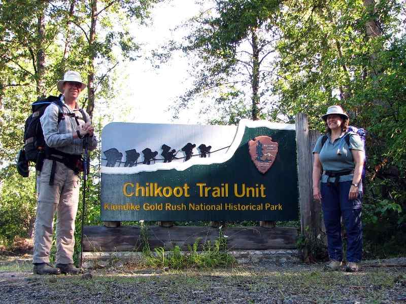
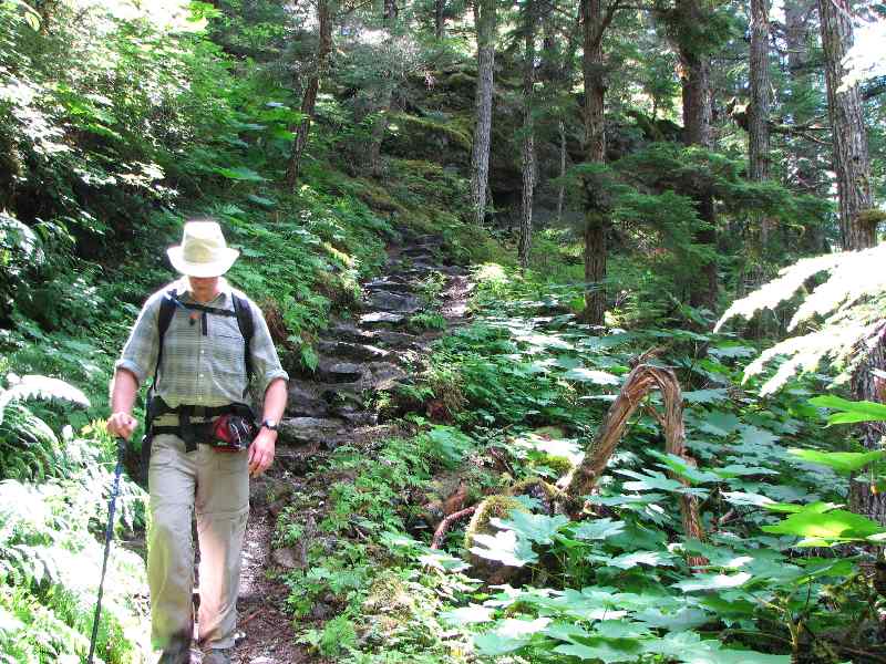
We had made arrangements to have Dyea Dave give us a ride to the trailhead, hoping to get an early start but Dave took his time, giving us the full blown tour. As a reward, however, we did see six Bald Eagles and learned some of the history of the area. We finally got on the Chilkoot Trail at about 11:20 AM, and with almost 19 kilometres to hike we put on a brisk pace, passing a few other hikers and day trippers. The first part of the trail was remarkably similar to the Westcoast Trail on Vancouver Island; lush greenery and a muddy track with roots sticking up. A few minor climbs made for a bit more interest as we enjoyed the perfect weather and we made it to Sheep Camp at quarter after seven. The campground was packed with people and we had to search for a vacant camp spot, finally finding a spot on the dirt crowded between other tents and near the cooking area. After supper a park ranger provided a short speech on what to expect for tomorrow's hike, which would include the Golden Stairs. The main point was to start early as it is quite a climb, so off to bed we went.
Start of the trail
Lush and green start to the Chilkoot Trail
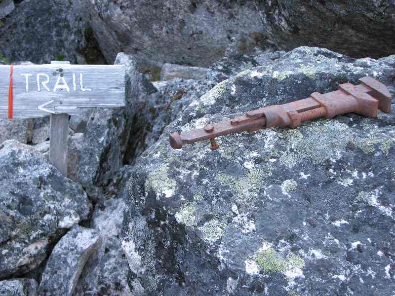
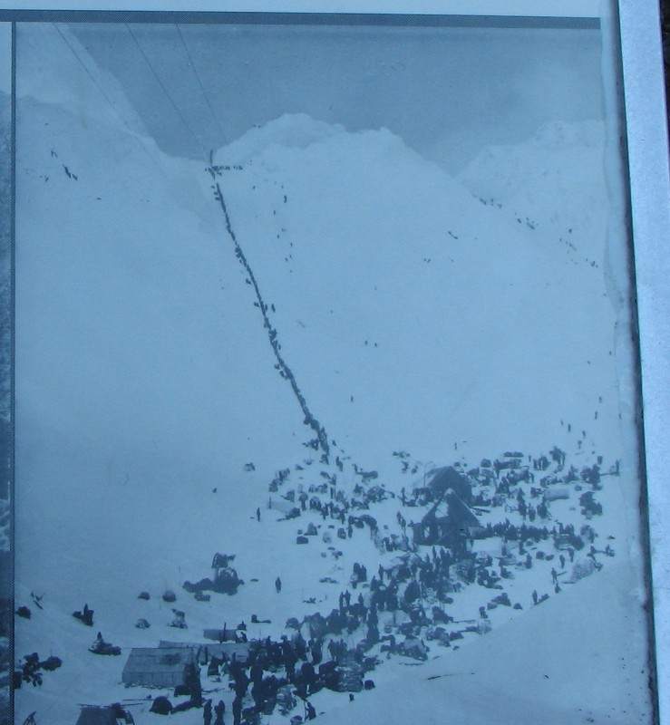
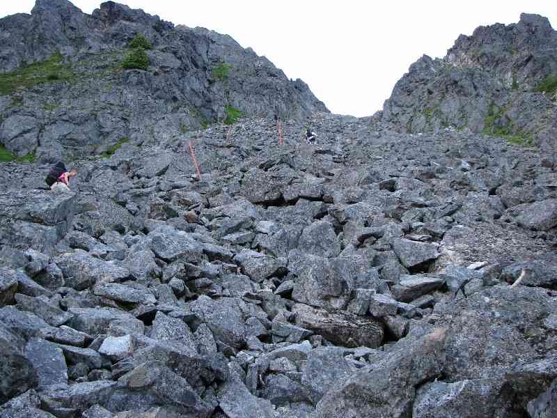
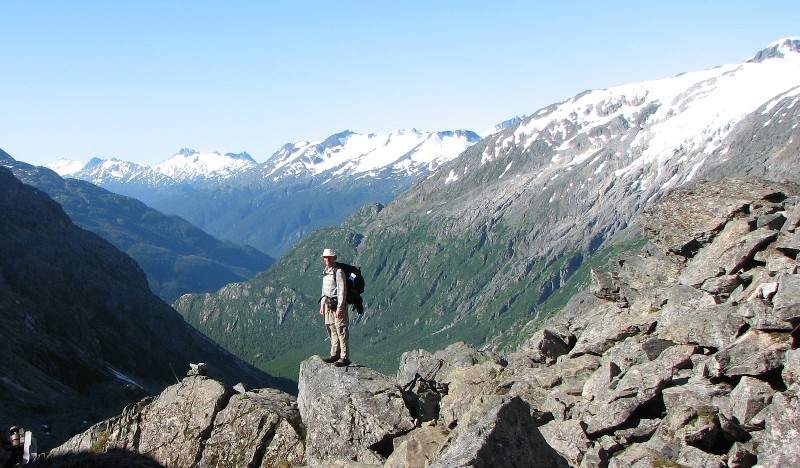
Saturday's pre-dawn light showed that we were again in for a perfect day so after a very quick breakfast we packed up and were on the trail at the crack of dawn. A gradual climb up the valley gave way to steeper sections with opening views back the way we had come. Littered along the trail were artefacts that most people would have called junk but here in their historic setting they represented the incredible effort that the gold seekers of 1898 went through to get to the gold fields in Dawson. When Superintendent Steele of the NWMP came in February of 1898 he initiated a minimum amount of provisions requirement for anyone crossing into Canada. The minimum would allow a person to survive for a year in the harsh environment of the Yukon and was said to weigh a ton, including hundreds of pounds of food and equipment. Thank goodness we were travelling light! We were especially thankful when we saw the Golden Stairs; a boulder field set on a 45 degree slope. This is the site of one of the most famous photographs taken during the gold rush showing a line of men going up the snow field. We took our time clambering over the enormous boulders that sometimes shifted when putting weight on them and made it to the false summit in less than an hour. The view back was simply stunning but we didn't linger, instead pushing on to the ranger station at the summit for a lunch break. After lunch it sure was fun sliding down the snowfield into B.C. towards Crater Lake. We made it to Happy Camp at a reasonable time but after a good rest decided to push on to Deep Lake so that we could have a shorter hike the next day. It sure was a long four kilometres.
Artefact along the trail
Gold Rush Stampeders climbing the Golden Stairs in Winter of 1898
Climbing the Golden Stairs in Summer of 2006
False summit provides spectacular views
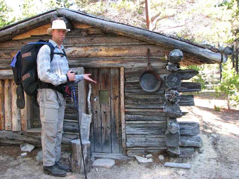
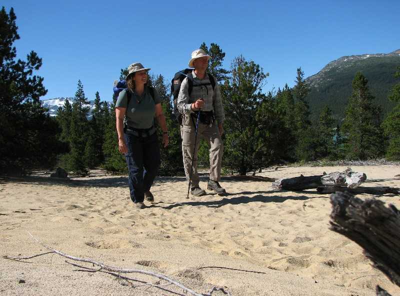
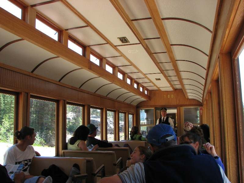
Sunday, July 30, would be one of the longest days on the trip and probably any trip we've done. It started by getting on the trail at 6:30 AM (our time, 4:30 Alaska time) and making quick work of the trek to Lindeman City where a small museum was set up in a tent. We really enjoyed looking at the historic photos on display. As a number of other hikers were also working to catch the train we fell in step with a family leaving the campground at Lindeman and then another group of hikers leaving Bare Loon Lake campground. At Bare Loon we had the last of our food with another seven kilometres to hike. A long section of the trail was in loose sand, similar to walking on a beach; what hard work after hiking fifty kilometres. As we arrived at Bennett we could hear a whistle blowing and our train pulled into the station; perfect timing. The train trip included a boxed lunch that fortunately we could have before boarding the train as it was still an hour prior to departure. The five hour train ride back to Skagway was especially relaxing and we enjoyed the views of White Pass that we had missed on the foggy motorcycle ride only a few days prior.
Another in the series of Ekke and Short Doors
Who knew we were going to be slogging on the beach?
Refurbished rail car from the 19th Century
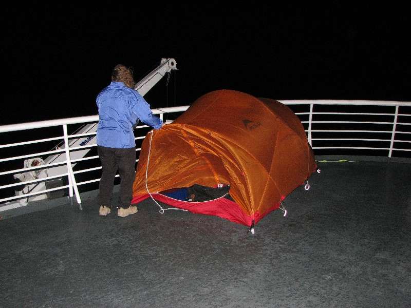
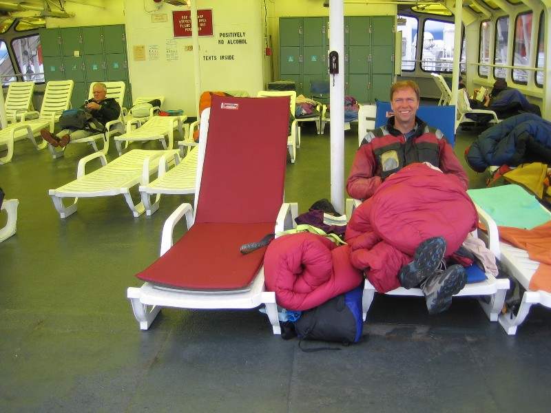
Back in Skagway at about 6:30 PM, 12 hours after leaving Deep Lake campground, we devoured a giant plate of nachos before liberating the motorcycles which had been locked and covered on the street in front of the Westmark Inn. We then headed off to a laundromat to freshen the clothes we had lived in for three days straight and then prepared for a two night cruise down the Inside Passage. The Matanuska was ready for boarding at about midnight our time. We were pretty tired but we secured the bikes and then went up to the solarium to pitch our tent. We had been looking forward to this for some time and had specifically not purchased a cabin just so we could sleep on the deck. Our imaginations had not included gale force winds. We got the tent strapped to the railing by about 2:00 AM and our luggage and Thermarests inside for a well-deserved sleep but the incredible flapping of the tent had us imagining the worst; a ruined tent in tatters. So, down came the tent and we dragged it into the solarium where others had thrown their sleeping bags on the deck chairs. A few minutes after settling in on the reclined deck chairs we noticed a light rain was falling and our sleeping bags were getting wet so we moved to a location further inside the shelter. The new location was too warm under the heat lamps as our sleep masks seemed to absorb the infrared radiation so we picked everything up again and moved to our final spot at about 3:30 AM. Finally sleep. What a day.
The tent is almost strapped down to the poop deck of the Matanuska
Enjoying the solarium
The Matanuska pulled into Juneau, Alaska at about 8:30 and we were roused from our fitful slumber by the commotion of passengers disembarking. The hot shower really boosted our spirits after a couple of shower-free days on the trail. The low, grey clouds hampered our view for much of the day but we did enjoy the sight of the Mendenhall Glacier near Juneau. All-in-all shipboard life was pretty relaxing, watching the scenery float by, eating in the cafeteria and keeping our eyes peeled for whales. As the voyage progressed the cost of a stateroom dropped until finally, after Petersburg it had dropped to $87. Fortunately there was a room available and we snapped it up. Both of us zonked out and slept like logs for the whole night waking up in the same position we went to sleep in.
August 1 we disembarked from the ferry at 11:30 AM in Prince Rupert. A fellow motorcyclist asked if it would rain on the ride to which I responded with buoyant confidence that it would not. Confidence doesn't necessarily mean correctness and it started to rain about five minutes after we left the ship while standing in line for customs. A couple of hours later we finally left Prince Rupert and rode to Prince George in an on-again, off-again rain. The scenery was almost haunting with the mountains shrouded in mist along the Skeena River, looking like the mountains along the Yangtze River in China. We made it to an RV park just outside Prince George 740 kilometres later at about 10:00 PM.
The next day we got on the road fairly early and made it to Jasper by 2:00 PM. This gave us time to go grocery shopping and check in at the ranger station for our next planned hike, the Skyline Trail. At the laundromat Marilyn, from Audrey's school, said "Hello" and we had a nice chat about their vacation and our trip. We then met Ekke and Magda (my parents), Vic and Gloria (friends from Airdrie) and Peter and Inge (friends from Germany) at the Whistlers Campground to prepare for tomorrow's hike.
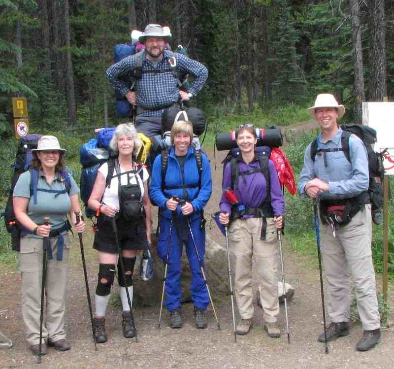
We stored the motorcycles at the campsite where Vic and Ekke Sr. would be staying and then piled into the motorhome for a lift to the start of the Skyline Trail at Maligne Lake. The six of us put on our heavy packs and waved goodbye at about 1:00 PM, planning to meet up with Vic and Ekke Sr. four days hence at Maligne Canyon. The hike to Little Shovel campground was mostly in the trees and a bit of cloud meant that there were no views to be had so it was an uneventful walk in the woods. Our three tents were the only ones at the backcountry campground providing a welcome sense of tranquility compared to the busy Chilkoot Trail.
Ready to hike the Skyline Trail
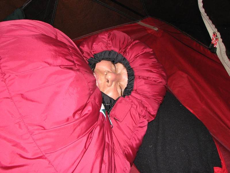
Snuggled up on the first night
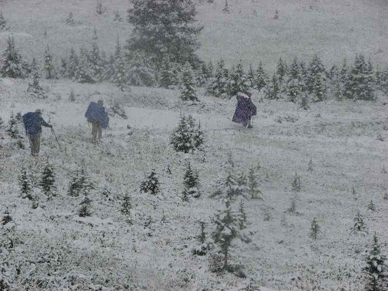
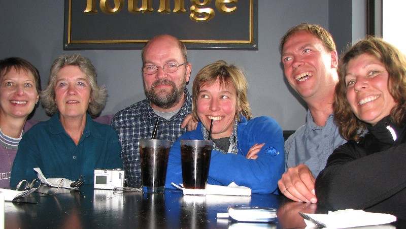
The morning dawned grey and cloudy with a bit of rain. We managed to have breakfast and pack up without getting too wet but as we started hiking the rain became fairly steady. Then it started getting colder. As we climbed higher the occasional snowflake mixed in with the rain and soon enough it was a little rain mixed in with the snow. Eventually we were trudging through a full-blown snowstorm on a slippery trail. It can be difficult to stay dry in those kinds of conditions and we were all a bit damp and cold. A park ranger coming the other way told us that the snow was getting deeper and gave us some suggestions on which trail to take to get out of the area in case we didn't want to climb "The Notch" with its exposed slopes. He also demanded to see the backcountry permit which was buried deep in a backpack to stay dry. At lunch time we got to the appropriately named Snow Bowl camp and were walking through 10 or 20 centimetres of snow. The temperature was about minus two Celsius. Some of the hikers were concerned that the sleeping bags were getting wet and that it could be dangerous to camp in these conditions. While some thought it would be OK to go on, the group consensus was that we should turn back. After a quick bite to eat we retreated the way we had come. When we got to Little Shovel we took a break and decided to go all the way back to Maligne Lake. We got to the lodge at about 5:30 PM but when we tried phoning Vic's cell phone there was no response. Fortunately a shuttle bus was preparing for departure back to Jasper so we hitched a ride with them. In town we tried Vic's cell phone repeatedly without success so we holed up in Earls restaurant until we finally got through at about 9:00 PM when Vic could pick us up. We were all in agreement that we should try the trail again some time in better weather but if the August long weekend couldn't provide the perfect weather when could we expect it? In any case, next summer we would be continuing our RTW journey and not have time for another backpacking adventure until reaching Machu Picchu in October.
Cold and wet climb up to Snow Bowl
Earls Lounge is warm and dry!
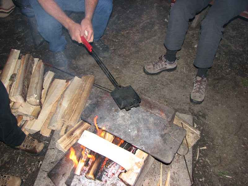
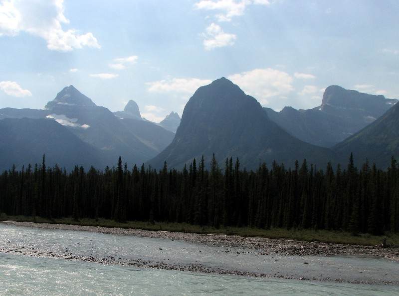
The R1150 had developed a fuel leak in the short time we were hiking so we spent the better part of Saturday trying to repair it with some silicone sealant. In the evening we tried "bush pies" over the open fire, basically two slices of bread with jam or other topping in the middle put into a griddle, and they were delicious. Sunday had some of us go on a day hike into Maligne Canyon as the weather had improved markedly while others lazed around camp reading. Monday we left family and friends, taking the Icefields Parkway down to Lake Louise and then home. The Parkway is one of the most beautiful rides in the entire world and after a 9,000 kilometre journey to Inuvik and Alaska it was almost anticlimactic to have the most spectacular scenery virtually in our back yard.
Another "bush pie" on the fire
Some of the most spectacular scenery of the trip
Epilogue/Prologue
After having the bikes serve us so faithfully for the trip north, I decided to sell the R1150GS Adventure so that I could take the old 1989 R100GS that I used for our European adventure. It was tough selling the best bike I've ever owned but the old bike is so much lighter and less expensive (an important consideration for the Carnet de Passage) that it seemed like the right decision. The winter will be spent doing a thorough overhaul of the R100 and a minor prep of the F650 so that in July of 2007 we can go south and continue our RTW journey.
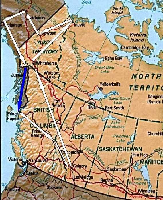
Map of the Inuvik and Alaska Chapter
Home / Inuvik NWT | 2006
Inuvik NWT | 2006
We started the first leg of our RTW (round the world) trip by riding as far north in Canada as it is possible to ride. The rest of the story will unfold in the following chapters.First up was the Lunatic Fringe rally put on by the Rocky Bow BMW Riders in High River, Alberta. It was a small affair this year because of a conflict in the rally schedule with a big national event held in Boise, Idaho on the same July 8 weekend. Nevertheless, we had a great time. The long distance award went to Paul Harper who flew his bike to the east coast of the U.S. from the U.K. and had spent a few weeks on the road working his way west. (www.thebigbiketrip.com) We led a ride-out on Saturday morning and put on the field events in the afternoon and while the word "diabolical" did not come up there were some comments made about how challenging the events were. On Sunday morning, July 9, we packed up and headed north, hoping to camp in Jasper that evening. We only made it a couple of blocks when Audrey motioned that the oil pressure light on her F650GS was on. Uh oh. We performed a few simple checks but the light refused to go out so we called the CAA for a tow. When the tow truck driver showed up with a motorcycle trailer we thought we would be in good hands but when he said that he had never towed a bike before a bit of uneasiness crept in. We doubled up on the R1150 and followed the tow truck all the way to Blackfoot Cycle. Followed at a respectable distance that is, in case the unthinkable happened and Audrey's bike went for a tumble.
Around the campfire at the Lunatic Fringe BMW rally

Blackfoot checked the F650 over on Monday and found that the oil pressure sensor wiring had shorted out, an easy fix. Finally, Tuesday morning we rode north, skipping Jasper and having only lost a couple of days. Highway 22 was not terribly interesting but we made good time. In a couple of days we were at the start of the Alaska Highway in Dawson Creek. Wherever we stopped, be it for fuel or simply for a break, people would come up to us and start a conversation. So, if you are ever starved for company simply strap a couple of knobbly tires to the back of a motorcycle and hang out at a coffee shop!
Conversation starters

The famous Alaska Highway turned out to be a pretty easy ride. All smooth pavement with only a few construction zones where rock chips were being put down. A bit of excitement happened when a caribou jumped out from behind a parked motorhome right into our path. Thank goodness for powerful brakes and quick reaction times or we could have had caribou burgers for lunch. The Alaska Highway did present us with a lot of wildlife. A couple of grizzly bear cubs had us wondering where mama bear was and a small fox walking toward us in the middle of the opposite lane ignored us completely when we rode by. It was probably too busy balancing a large bird in its jaws to even see us.
A local newspaper reporter takes our photo in Dawson Creek

Where's mom?

After a mid-afternoon dip in the Liard Hot Springs we crossed the 60th parallel into the Yukon Territory on Thursday the 13th of July. We camped at Watson Lake, home of the famous sign-post forest, and found the mosquitoes to be almost unbearable. A cooking shelter with screened windows allowed us to make and eat supper in a protected environment. A short ride on Friday got us to Whitehorse where we hoped to mount the knobbly tires to take us on the gravel roads up to Inuvik. The first motorcycle shop we stopped at said that they could mount the tires but it would be about two weeks to the next available appointment. Down the street, Yukon Honda, was much more accommodating. I pulled the wheels, one by one, off the bikes and the parts manager mounted the tires right away. Great service and only $20 for each tire. By the time we got to the Greyhound depot they were closed for the weekend so we ended up taking the street tires to Mailboxes Etc. to ship back home. While the knobbly tires were great conversation starters when strapped to the back of the bikes they did make it rather awkward to get into the luggage so we were glad to be rid of that burden. The Robert Service Campground in Whitehorse was a very nice facility but unfortunately the July 15th weekend had a softball tournament at the diamonds across the road. Softball partiers at the campground made it rather unpleasant but at least we had earplugs with us. Another advantage to travelling by motorcycle!
Watson Lake signpost forest

Yukon Honda

Saturday we did a walking tour of Whitehorse. Starting at the campground we climbed up the escarpment around the airport to Beringia. This is a great interactive museum of the time of the last ice age, the time of the great woolly mammoth. Did you know that the modern camel evolved in North America or that this part of the Yukon was not under a great sheet of ice during the ice age? We got to try throwing a spear using an adladl, under the watchful eye of an interpreter, and discovered that Audrey has the better throwing arm. The only way I could have put food on the table 10,000 years ago would have been if the 400 pound beaver walked into the pot all by itself. After the museum we walked around the other side of the airport and down the escarpment to downtown Whitehorse. It truly is a nice, small city on the banks of the Yukon River.
400 lb beaver from the time of Beringia

Look out Audrey!

Run, Ekke, run!

We departed from the Alaska Highway on Sunday morning, turning north on the Klondike Highway to Dawson. Again, this road was perfectly paved and the riding was easy as we paralleled the Yukon River, the route taken by the Klondike Gold Stampeders. As we passed the intersection with the Dempster Highway we looked over and saw that the road seemed in pretty good shape. Nevertheless, we stopped in at the Yukon and Northwest Territories information centres in Dawson to get an idea of the road conditions up to Inuvik. We were told that the highway is well travelled and in good shape up to Tombstone Territorial Park, about 70 kilometres. After that the gravel gets looser and deeper so the riding should be more challenging. We were also warned about the shale used for the road near Eagle Plains as it can shred tires. The good news was that the weather forecast for the next few days was warm and dry, with a high of 24 Celsius in Inuvik. The Dempster has a reputation as an extremely challenging road on a motorcycle when it is wet so we were very happy.
On July 17th we rode back down the Klondike Highway a few kilometres to the intersection with the Dempster where a gas station allowed us to fill up since it is about 370 kilometres to the next station at Eagle Plains. In the café Tom, the owner of a BMW R1100GS parked outside, was polishing off a delicious looking breakfast so we joined him in a cup of coffee and exchanged stories. He had made the run up to Inuvik and back a couple of days ago and said the road was in great shape. We must have made an impression on him since he visited Anderwerks (www.anderwerks.com) in Calgary for some much needed service on his bike based on our recommendation and we met up again at the Horizons Unlimited gathering near Nelson, B.C. (www.horizonsunlimited.com/meetings/CanWest2006.php) a few weeks later. While Tom headed south we headed north. After a few hundred metres of pavement the road turned to gravel but it wasn't threatening at all, being very well packed. We kept the speed down to about 80 km/h though we could have gone much faster. This allowed us to enjoy the scenery as well as improve the fuel economy of the bikes. As per the visitor information, the ride to Tombstone was easy and the park itself was spectacular. We hoped to stay at the campground on the return trip. Beyond the park the road turned to looser gravel but we simply took it easy and enjoyed the ride. Until we hit a construction zone. Then it wasn't as enjoyable because the watered down clay provided an incredibly slippery surface, causing the bikes to slither from side to side, even with the nice, new knobbly tires. We couldn't imagine doing this in the rain for 1,500 kilometres back and forth to Inuvik at 30 km/h. We made it to Eagle Plains in the late afternoon and set up the tent. Rather than sit out with the mosquitoes making supper and since we were tired from the ride we elected to go into the lodge. The fish burger and the beef dip were pretty good!
Lunch on the tundra

Panorama along the Dempster Highway

The next morning we continued riding north. The shale around Eagle Plains wasn't that bad for the bikes and actually provided a bit of a respite from the loose gravel. With Fireweed framing the road we rode the short distance to the Arctic Circle for the obligatory photo. Then, riding through rolling hills we crested the pass in the Richardson Mountains that signalled the border between the Yukon Territory and the Northwest Territories. The stark beauty of the landscape was difficult to capture in photographs. At a view point overlooking the Ogilvie Ridge one could see a total distance of 180 kilometres and we know that there wasn't a soul in that panoramic vista. For that matter, there wasn't a living soul on the other side of the mountains either, perhaps for another thousand kilometres. That's what made the few people we met on the highway that much more special. Since there aren't many turnoffs from the Dempster Highway and everyone drives at approximately the same speed we tended to see the same people over and over. When we pulled over for a break if someone happened along they always stopped to see if we were OK. The automobile drivers seemed to suffer from a fair number of flat tires but our new knobblies had no troubles handling the sharp rocks. The road on the NWT side of the pass seemed to us to be a bit more challenging, with looser and deeper gravel. The ferries across the Peel and Mackenzie Rivers presented their own challenges as the approach ramps were dirt that had been pounded by heavy truck traffic. Once across the Peel River, and onto the Mackenzie Delta, the road became straight as an arrow and the scraggly trees were interrupted only by the occasional swamp. Still the loose gravel made the riding challenging and when we arrived in Inuvik we were exhausted. Dinner (Muskox burger!) and a celebratory Banana Split at the Eskimo Inn were about all we could manage after a walk around town. We were glad to have brought our "sleep masks" as the GPS indicated that we only had thirteen minutes of night, from 2:54 AM to 3:07 AM.
Fireweed frames the ride

Wright Pass

Happy!

Sleep mask required at Midnight

It would have been nice to spend a little time in Inuvik, especially since there was an arts festival going on, but having experienced the construction zones with the wet clay we decided to take advantage of the dry weather and ride back south. We couldn't believe how different the road was. It looked exactly the same but we were riding on gravel at 80 to 90 km/h that the day before had us going 60. The only thing we could tell that was different was that we were fresh in the morning whereas the previous afternoon we were tired. Twenty or thirty kilometres before the pass over the Richardson Mountains a motorcyclist coming from the other direction flagged us down and warned us about the loose gravel. This seemed like an odd statement since we had obviously been riding on gravel for a thousand kilometres up to Inuvik and back. He clarified and said that the loose gravel at the top of the pass combined with a strong cross wind had almost blown him off the road. Keeping that in mind we ascended the pass without difficulty. On the Yukon side, an especially strong and gusty wind came up and because we were standing on the pegs to balance the bikes on the loose gravel we were like human sails, catching the wind. Combined with a steep drop-off this made for some of the most exciting riding on the Dempster. (Audrey thinks I should use a stronger word than "exciting" here!) By the time we got back to Eagle Plains we were going 60 in places where we were going 80 the day before, so maybe the freshness theory has some validity. This is certainly something we should keep in mind for the rest of the trip.
Look out for the loose gravel

Balancing the bike by standing up on the pegs. Before the wind gusts...

Heading south

Crossing a famous latitude on our "Longitudinal Way Round"

A short ride took us from Eagle Plains to Tombstone Park where we stayed overnight. Arriving in the early afternoon allowed us to go for a nice hike in the park. While bushwhacking beside a stream we encountered a group of hikers returning from a five day hike back from Tombstone Mountain where they had been dropped off by a helicopter. What an adventure! Back at camp a pair of German motorcyclists had put up their tent near us. One of them was on a modern bike similar to ours but the other rider was on a forty year old BMW. Another adventure!
From Tombstone it was a short ride back to Dawson where a music festival was in full swing. The town was hopping with activity. We picked up our certificates for completing the Dempster Highway and crossing the Arctic Circle at the visitor info centre and got some information on historical tours. First up was a visit to the Robert Service cabin and a poetry reading by a Parks Canada interpreter. He was fabulous! We learned a lot and were well entertained. After that we jumped back on the bikes and rode up to historic Dredge No. 4. There another Parks Canada interpreter gave us a tour of the dredge and filled our heads with even more information. Back at camp (we were staying at the downtown RV park) we found another tent sharing our gravel spot. These people were down specifically for the music festival and the ensuing party. Our hopes that they would be fairly quiet were dashed as they talked well into the night. On the advice of the info centre staff we had avoided the government campground across the river since it has a reputation of being quite rowdy during the music festival. She had heard of the softball tournament rowdiness in Whitehorse and so recommended the downtown RV park. Too bad about the noisy neighbours and the loud music (a kilometre away!) but we were glad that it didn't get too rowdy.
Completion certificates at the NWT information centre

A Robert Service poetry reading by a Parks Canada interpreter

In the morning we did laundry and went over the bikes for loose bolts before taking one more Parks Canada tour. This time an interpreter took us for a walk around town, telling stories of the gold rush time period. Stories like the one about Soapy Smith in Skagway who opened a telegraph office that didn't have any telegraph wires connected to the outside world. He would take the message from the gold rush prospector and then come back to the customer and say that the reply was to "send money!" In reality no message was sent and Soapy pocketed some nice change. Another story was about the mortuary. Apparently the undertaker would size people up during the summer if they weren't looking very healthy. He would then dig the hole before the ground froze so that if the person died during the winter he wouldn't need to store the body. We packed the bikes back at the RV park and after lunch at a picnic table on the bank of the Yukon River we headed west. While the Top of the World Highway was ostensibly paved to the border it was in a sad state of repair, undergoing a fair bit of work with long stretches of loose gravel. We entered Alaska at Poker creek and rode a narrow, winding gravel road to Chicken. The story of how Chicken got its name was interesting; apparently the original settlers wanted to call it Ptarmigan but couldn't spell it! From Chicken a beautiful paved road took us past forest fires to Tok River State Park campground.
Parks Canada interpreter starts a tour of Dawson City

Over the Top of the World Highway

Taking pictures of a couple of moose

Tok River State Park

600 kilometres took us all the way to Denali National Park via Fairbanks on July 23. First we stopped at Delta Junction for the obligatory photo at the official end of the Alaska Highway. The sign wasn't anywhere near the road or the parking lot so we just rode the bikes up onto the sidewalk and then carefully balanced the camera on a garbage can to take the picture. We picked up a few groceries in Fairbanks and then had lunch on the fair banks of the Chena River that runs through the centre of town. The peace and quiet of the riverside picnic was shattered when speed boats and Jet-Skis went ripping by but other than that it was a great place for lunch. It was so warm that it was rather tempting to join them! In the late afternoon we arrived in Denali National Park and discovered one of the most confusing systems for transporting people and finding a campground we have ever seen. Perhaps their system works for locals who know the system and for tourists who have come here as a destination and have done their research but for us just dropping in out of the blue it was bizarre. Only the first part of the park is accessible by private vehicles so it is necessary to take a bus to go further in to the park and the bus must be booked in advance. Fortunately the line for talking to a park officer was long so we had plenty of time to try and figure the system out. There was a campground, accessible by private vehicle, a couple of kilometres back and they had a vacancy for walk-in campers. We could have booked a bus for a day trip for the next day but the one-way rides seemed really long (and slow) not to mention expensive. As it was, we were spending $32 just to camp for the night. Then we discovered that showers were $4 each. We thought that Denali might be expensive but not that much and we didn't expect it to be as busy as Yosemite or Yellowstone to boot. Since we were at a walk-in spot we parked the bikes in the parking lot and then carried all of our camping equipment a kilometre past all the RV spots. Later we thought, "Why didn't we just park the bikes in front of the camp spot to unload and then ride back to the parking lot?" but the exercise was a good warm up for the next day.
Official end of the Alaska Highway at Delta Junction

Healy Lookout was about a nine kilometre hike from the campground with 550 metres of elevation gain. We took a slightly different route having to cross an airfield and a set of railway tracks after bushwhacking for a kilometre or two before we started on the right trail. No views of Mt. McKinley were to be had from the top but we could see further up the valley into the park. Back at the campground we had a quick lunch before packing up and riding south to Anchorage. A few spots along the road were supposed to provide views of the tallest mountain in North America but the clouds and occasional rain obscured any peek we might have had. We arrived in Anchorage in the late afternoon and toured the small city before having supper at a Wendy's. We asked some locals for camping possibilities and were told that we had passed Eagle River state park coming in so we went back there to set up camp for the night. It was a long day with the hike in the morning and the 400 kilometre ride in the afternoon so we were pretty happy to see our tent set up by 10:20 PM.
July 25 we rode about 500 kilometres back to Tok River. We passed the Matanuska Glacier on the Glenn Highway and then stopped for lunch in Eureka. A couple of Swiss riders came in just as we were leaving so we chatted for a little while before continuing north. After a short stretch on the Richardson Highway we took the Tok Cutoff for one of the most challenging rides of the entire trip. The road wasn't so bad but the construction just outside of Tok was horrendous. By now we had plenty of experience on gravel but this stuff was composed of softball sized and shaped rocks. One of the flag persons waved the motorcycles to the front so that we wouldn't have to ride in the dust which would have been terrific if we weren't behind a couple of really nice custom Harleys from whatever state has licence plates that read, "First in Flight". They rode at 5 kph and at that speed the bikes were so unstable that it was a real fight to stay upright. Finally we stood up on the pegs and passed them, trying not to spray their nice paint jobs with gravel, and once we got up to a reasonable speed it wasn't nearly as scary.
Matanuska Glacier

A couple of Swiss bikers stop in just as we're leaving Eureka

The 620 kilometres to Whitehorse could have gone a bit faster without the construction at beautiful Kluane Lake or the incredibly long time for tea and toast to be delivered at the restaurant in Beaver Creek. As Canada's westernmost community perhaps the residents are used to being behind the rest of Canada and were in no hurry to serve us? After the cool and damp ride the hot showers at Robert Service campground were especially welcome.
Who would have thought that a 200 kilometre ride could be so miserable? That's all it was to Skagway over the White Pass but it was so cold, wet and foggy that not only did we see nothing we were soaked and freezing. On the bright side, the border guard entering the U.S. was the friendliest border guard we have ever met. He sympathised with our wet condition by not needing to see our paperwork and telling us that it was only eight miles into town where nice warm, dry hotels were waiting. We took his advice and settled in to the Westmark Inn to dry all of our stuff out, rather than camping near the head of the Chilkoot Trail. We picked up our train tickets and then checked in at the park office to register for the trail. The park warden wasn't too happy with our decision to hike the trail in 2.5 days, saying that we could not possibly enjoy the hike and its historical significance in that time. Oh well, the train was booked and it was scheduled to depart from Lake Bennett at 1:30 PM on Sunday and the ferry to Prince Rupert was booked and scheduled to depart on Sunday at 11:30 PM so we didn't have much in the way of choices at this point. A walk around Skagway revealed that it was a real cruise ship town. The main street was lined with expensive trinket shops selling everything from Alaskan gemstones to T-shirts and the sidewalks were overflowing with "cruisers". By 8:00 PM the streets were deserted and the cruise ships pulled out of the harbour leaving the few remaining people standing around looking at each other and asking, "What just happened here?"
Cruise ship parking on Main Street, Skagway

We had made arrangements to have Dyea Dave give us a ride to the trailhead, hoping to get an early start but Dave took his time, giving us the full blown tour. As a reward, however, we did see six Bald Eagles and learned some of the history of the area. We finally got on the Chilkoot Trail at about 11:20 AM, and with almost 19 kilometres to hike we put on a brisk pace, passing a few other hikers and day trippers. The first part of the trail was remarkably similar to the Westcoast Trail on Vancouver Island; lush greenery and a muddy track with roots sticking up. A few minor climbs made for a bit more interest as we enjoyed the perfect weather and we made it to Sheep Camp at quarter after seven. The campground was packed with people and we had to search for a vacant camp spot, finally finding a spot on the dirt crowded between other tents and near the cooking area. After supper a park ranger provided a short speech on what to expect for tomorrow's hike, which would include the Golden Stairs. The main point was to start early as it is quite a climb, so off to bed we went.
Start of the trail

Lush and green start to the Chilkoot Trail

Saturday's pre-dawn light showed that we were again in for a perfect day so after a very quick breakfast we packed up and were on the trail at the crack of dawn. A gradual climb up the valley gave way to steeper sections with opening views back the way we had come. Littered along the trail were artefacts that most people would have called junk but here in their historic setting they represented the incredible effort that the gold seekers of 1898 went through to get to the gold fields in Dawson. When Superintendent Steele of the NWMP came in February of 1898 he initiated a minimum amount of provisions requirement for anyone crossing into Canada. The minimum would allow a person to survive for a year in the harsh environment of the Yukon and was said to weigh a ton, including hundreds of pounds of food and equipment. Thank goodness we were travelling light! We were especially thankful when we saw the Golden Stairs; a boulder field set on a 45 degree slope. This is the site of one of the most famous photographs taken during the gold rush showing a line of men going up the snow field. We took our time clambering over the enormous boulders that sometimes shifted when putting weight on them and made it to the false summit in less than an hour. The view back was simply stunning but we didn't linger, instead pushing on to the ranger station at the summit for a lunch break. After lunch it sure was fun sliding down the snowfield into B.C. towards Crater Lake. We made it to Happy Camp at a reasonable time but after a good rest decided to push on to Deep Lake so that we could have a shorter hike the next day. It sure was a long four kilometres.
Artefact along the trail

Gold Rush Stampeders climbing the Golden Stairs in Winter of 1898

Climbing the Golden Stairs in Summer of 2006

False summit provides spectacular views

Sunday, July 30, would be one of the longest days on the trip and probably any trip we've done. It started by getting on the trail at 6:30 AM (our time, 4:30 Alaska time) and making quick work of the trek to Lindeman City where a small museum was set up in a tent. We really enjoyed looking at the historic photos on display. As a number of other hikers were also working to catch the train we fell in step with a family leaving the campground at Lindeman and then another group of hikers leaving Bare Loon Lake campground. At Bare Loon we had the last of our food with another seven kilometres to hike. A long section of the trail was in loose sand, similar to walking on a beach; what hard work after hiking fifty kilometres. As we arrived at Bennett we could hear a whistle blowing and our train pulled into the station; perfect timing. The train trip included a boxed lunch that fortunately we could have before boarding the train as it was still an hour prior to departure. The five hour train ride back to Skagway was especially relaxing and we enjoyed the views of White Pass that we had missed on the foggy motorcycle ride only a few days prior.
Another in the series of Ekke and Short Doors

Who knew we were going to be slogging on the beach?

Refurbished rail car from the 19th Century

Back in Skagway at about 6:30 PM, 12 hours after leaving Deep Lake campground, we devoured a giant plate of nachos before liberating the motorcycles which had been locked and covered on the street in front of the Westmark Inn. We then headed off to a laundromat to freshen the clothes we had lived in for three days straight and then prepared for a two night cruise down the Inside Passage. The Matanuska was ready for boarding at about midnight our time. We were pretty tired but we secured the bikes and then went up to the solarium to pitch our tent. We had been looking forward to this for some time and had specifically not purchased a cabin just so we could sleep on the deck. Our imaginations had not included gale force winds. We got the tent strapped to the railing by about 2:00 AM and our luggage and Thermarests inside for a well-deserved sleep but the incredible flapping of the tent had us imagining the worst; a ruined tent in tatters. So, down came the tent and we dragged it into the solarium where others had thrown their sleeping bags on the deck chairs. A few minutes after settling in on the reclined deck chairs we noticed a light rain was falling and our sleeping bags were getting wet so we moved to a location further inside the shelter. The new location was too warm under the heat lamps as our sleep masks seemed to absorb the infrared radiation so we picked everything up again and moved to our final spot at about 3:30 AM. Finally sleep. What a day.
The tent is almost strapped down to the poop deck of the Matanuska

Enjoying the solarium

The Matanuska pulled into Juneau, Alaska at about 8:30 and we were roused from our fitful slumber by the commotion of passengers disembarking. The hot shower really boosted our spirits after a couple of shower-free days on the trail. The low, grey clouds hampered our view for much of the day but we did enjoy the sight of the Mendenhall Glacier near Juneau. All-in-all shipboard life was pretty relaxing, watching the scenery float by, eating in the cafeteria and keeping our eyes peeled for whales. As the voyage progressed the cost of a stateroom dropped until finally, after Petersburg it had dropped to $87. Fortunately there was a room available and we snapped it up. Both of us zonked out and slept like logs for the whole night waking up in the same position we went to sleep in.
August 1 we disembarked from the ferry at 11:30 AM in Prince Rupert. A fellow motorcyclist asked if it would rain on the ride to which I responded with buoyant confidence that it would not. Confidence doesn't necessarily mean correctness and it started to rain about five minutes after we left the ship while standing in line for customs. A couple of hours later we finally left Prince Rupert and rode to Prince George in an on-again, off-again rain. The scenery was almost haunting with the mountains shrouded in mist along the Skeena River, looking like the mountains along the Yangtze River in China. We made it to an RV park just outside Prince George 740 kilometres later at about 10:00 PM.
The next day we got on the road fairly early and made it to Jasper by 2:00 PM. This gave us time to go grocery shopping and check in at the ranger station for our next planned hike, the Skyline Trail. At the laundromat Marilyn, from Audrey's school, said "Hello" and we had a nice chat about their vacation and our trip. We then met Ekke and Magda (my parents), Vic and Gloria (friends from Airdrie) and Peter and Inge (friends from Germany) at the Whistlers Campground to prepare for tomorrow's hike.
We stored the motorcycles at the campsite where Vic and Ekke Sr. would be staying and then piled into the motorhome for a lift to the start of the Skyline Trail at Maligne Lake. The six of us put on our heavy packs and waved goodbye at about 1:00 PM, planning to meet up with Vic and Ekke Sr. four days hence at Maligne Canyon. The hike to Little Shovel campground was mostly in the trees and a bit of cloud meant that there were no views to be had so it was an uneventful walk in the woods. Our three tents were the only ones at the backcountry campground providing a welcome sense of tranquility compared to the busy Chilkoot Trail.
Ready to hike the Skyline Trail

Snuggled up on the first night

The morning dawned grey and cloudy with a bit of rain. We managed to have breakfast and pack up without getting too wet but as we started hiking the rain became fairly steady. Then it started getting colder. As we climbed higher the occasional snowflake mixed in with the rain and soon enough it was a little rain mixed in with the snow. Eventually we were trudging through a full-blown snowstorm on a slippery trail. It can be difficult to stay dry in those kinds of conditions and we were all a bit damp and cold. A park ranger coming the other way told us that the snow was getting deeper and gave us some suggestions on which trail to take to get out of the area in case we didn't want to climb "The Notch" with its exposed slopes. He also demanded to see the backcountry permit which was buried deep in a backpack to stay dry. At lunch time we got to the appropriately named Snow Bowl camp and were walking through 10 or 20 centimetres of snow. The temperature was about minus two Celsius. Some of the hikers were concerned that the sleeping bags were getting wet and that it could be dangerous to camp in these conditions. While some thought it would be OK to go on, the group consensus was that we should turn back. After a quick bite to eat we retreated the way we had come. When we got to Little Shovel we took a break and decided to go all the way back to Maligne Lake. We got to the lodge at about 5:30 PM but when we tried phoning Vic's cell phone there was no response. Fortunately a shuttle bus was preparing for departure back to Jasper so we hitched a ride with them. In town we tried Vic's cell phone repeatedly without success so we holed up in Earls restaurant until we finally got through at about 9:00 PM when Vic could pick us up. We were all in agreement that we should try the trail again some time in better weather but if the August long weekend couldn't provide the perfect weather when could we expect it? In any case, next summer we would be continuing our RTW journey and not have time for another backpacking adventure until reaching Machu Picchu in October.
Cold and wet climb up to Snow Bowl

Earls Lounge is warm and dry!

The R1150 had developed a fuel leak in the short time we were hiking so we spent the better part of Saturday trying to repair it with some silicone sealant. In the evening we tried "bush pies" over the open fire, basically two slices of bread with jam or other topping in the middle put into a griddle, and they were delicious. Sunday had some of us go on a day hike into Maligne Canyon as the weather had improved markedly while others lazed around camp reading. Monday we left family and friends, taking the Icefields Parkway down to Lake Louise and then home. The Parkway is one of the most beautiful rides in the entire world and after a 9,000 kilometre journey to Inuvik and Alaska it was almost anticlimactic to have the most spectacular scenery virtually in our back yard.
Another "bush pie" on the fire

Some of the most spectacular scenery of the trip

Epilogue/Prologue
After having the bikes serve us so faithfully for the trip north, I decided to sell the R1150GS Adventure so that I could take the old 1989 R100GS that I used for our European adventure. It was tough selling the best bike I've ever owned but the old bike is so much lighter and less expensive (an important consideration for the Carnet de Passage) that it seemed like the right decision. The winter will be spent doing a thorough overhaul of the R100 and a minor prep of the F650 so that in July of 2007 we can go south and continue our RTW journey.
Map of the Inuvik and Alaska Chapter

